There's a direct bus from Xiahe to Langmusi, but it leaves early in the morning, and often sells out; if you miss it, you have to connect in Hezuo, which is midway between the two. The bus takes about four hours, or slightly longer with stops. You can find a nice list of your bus options to Langmusi
here.
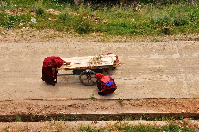
Helit and I met a Spanish schoolteacher on the bus, and we ended up sticking together for the bus ride and our time in Langmusi. Other than us, almost all the rest of the passengers were excitable Chinese tourists. We stopped a couple of times on the way: once by a lake, where all the Chinese jumped out and rapidly snapped pictures and ran for the bathroom; and once on a plain near some Tibetan herders who were waiting for the bus and sold the Chinese tourists short horse rides.
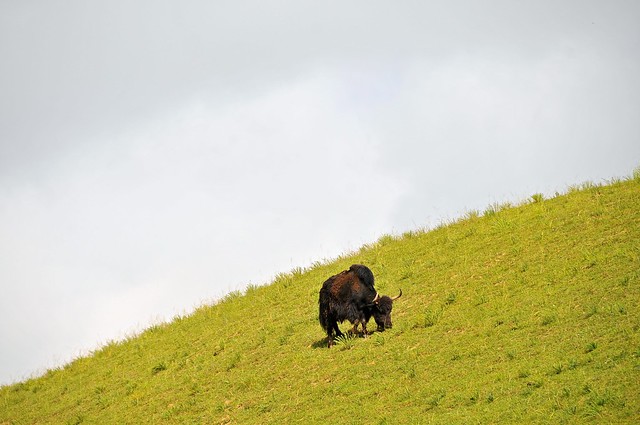 |
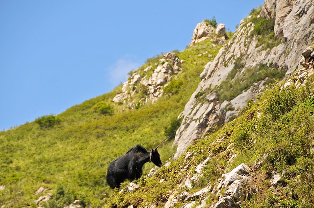
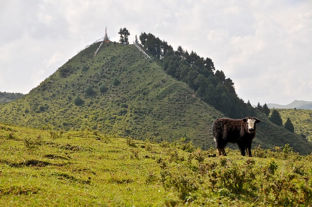
| A yak at the second stop. |
 |
| I took pictures while the Chinese took short horse rides. I'm sure the bus driver got kickbacks from the herders cum horse-wranglers. |
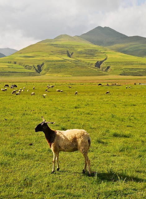 |
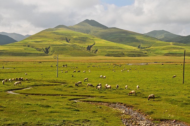
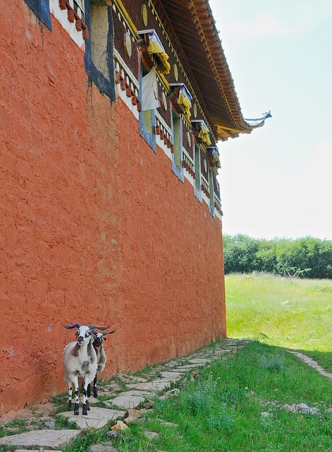
| The sheep have horns. Unlike the sheep I would see in Central Asia, these are not fat-tail sheep. |
Unlike the trip from Langmusi to Xiahe, it's not really that noticeable that you're going uphill, but the elevation changes from the 2,900 meters in Xiahe to about 3,300 meters in Langmusi.
We arrived around noon, and then searched for somewhere to stay. The Chinese construction boom had reached Langmusi, with both roadworks and hotel construction was in full swing, and tourism seemed to be booming. A symptom of this was that beds were in short supply, and it took a while to find a place to stay. We found a place in the Muslim quarter, and run by Tibetans. It had a nice front patio perched over the stream, and although the rooms were nice the bathroom facilities were even worse than the Overseas Tibetan Hotel: they positively reeked of ammonia. Thankfully, they were so ill-lit that you couldn't fully grasp how dirty they were.
I saw a couple of other hostel bathrooms in Langmusi, and they were no nicer, with with squat toilets that visibly flushed into ditches, and things like that. The Chinese very much take these sorts of setups in stride, which is hardly surprising given that even in major cities you can find bus-station toilets that are just tiled trenches a couple of feet deep, and everyone just lines up over them and squats, with "flushing" happening when water is periodically run down the ditch to wash the shit away. Bathrooms are dirty places where dirty things happen, and that's an accepted fact of life.
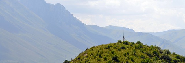
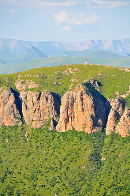
Anyway, after finding a place to stay, we set out on a hike to the Red Rock Mountain just west of town, which you pass on your way into town. We had seen some maps made by a tour outfit, and it looked like it would be fairly straightforward to circle around to the far side of the mountain and ascend it from there. Unfortunately, the map was wildly misleading and the road that was supposed to be the beginning of the path quickly deteriorated into an empty, unmarked field with no discernible path to the top, but lots of thick bushes. Stubborn as I am, I wasn't going to give up, so I pushed onwards up ever steeper and more hostile slopes while the girls turned back. I ended up having to scramble and crawl my way up through a steep section to summit one part of the mountain, only to have to retreat and re-ascend to get to the main mountaintop, as I was on a secondary peak.
 |
| The view from midway up the mountain, before things got tough. |
 |
| If this is the view you get when you're climbing Red Rock Mountain, you're doing it wrong. I had just scrambled up and through a thicket of trees like you see on the left and bottom of the screen. |
 |
| It wasn't that difficult, as Tibetans obviously make it here with some frequency. |
 |
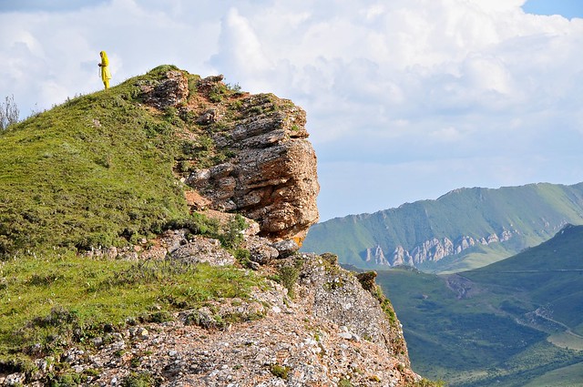
| The view of the town from the secondary summit. |
 |
| Looking away from town towards where I climbed up. I had to plunge back down through the trees, hug the mountain to the right, and scramble back up through more brush to reach the mountaintop proper. |
As I explored the main peak, I noticed that if we had
taken a more straightforward approach from the town side, we could have
easily walked up a saddle-like ramp by simply following the telephone
poles that ran up the mountain. Sheesh. Let me tell you, it's times like
this that you realize just how useful GPS and GPS trails would be.
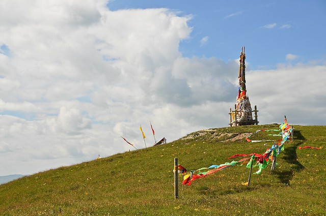
 |
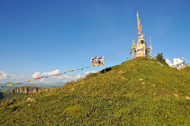
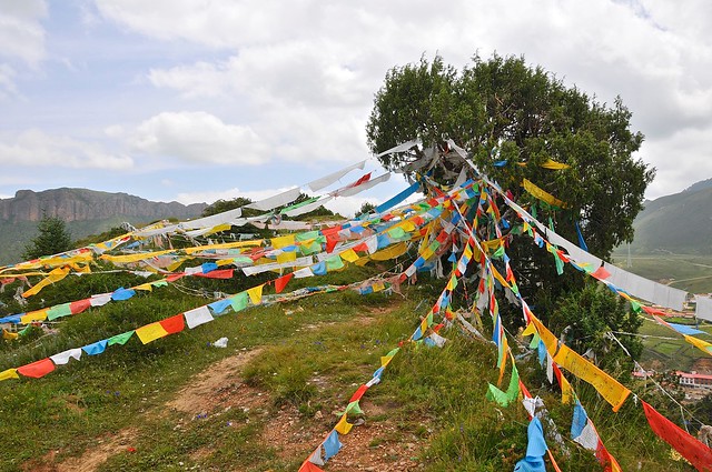
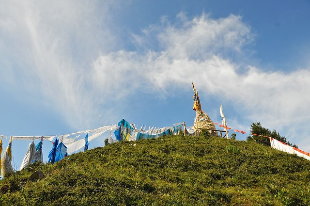
| Once you make the main summit, you can see prayer flags and the main part of the mountain, separated by a saddle-back depression that would have been much easier to climb up. |
 |
| From the other side of the saddle. |
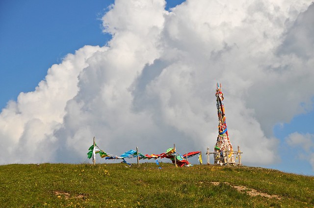 |
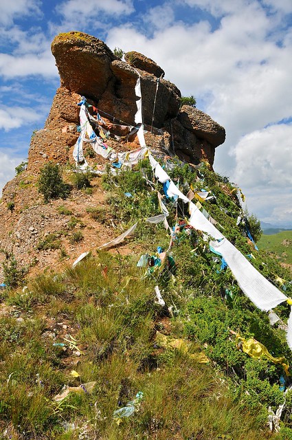
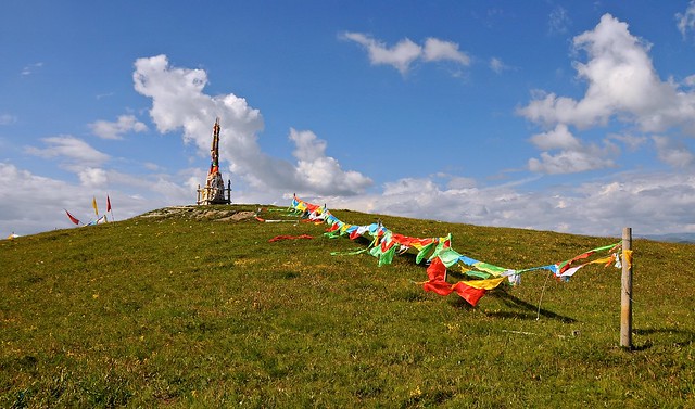
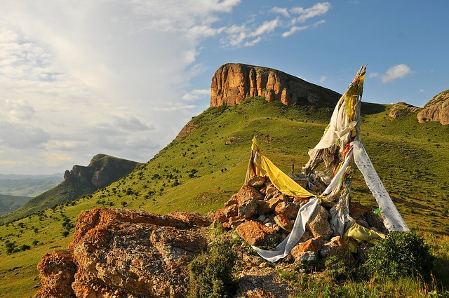
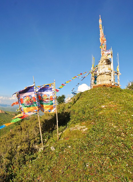
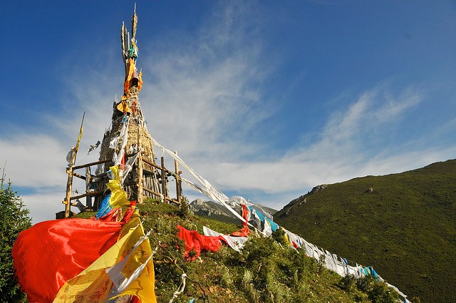
| As usual, the latse was on the highest part of the main mountain. |
 |
| A row of khatag lead to the main cairn. There's another row in the opposite direction, too. |
 |
| A very colourful fence in a field of wildflowers atop the mountain. |
 |
| It felt so vibrant and lush it was difficult to believe that the tabletop was at about 3,675 m. |
 |
| I'm a firm believer you can't have too many pictures of things as beautiful as this. |
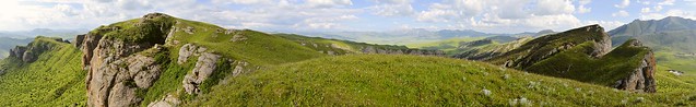
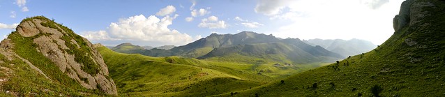
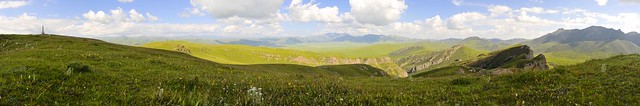 |
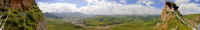
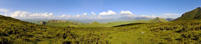
| Panorama of the mountaintop. |
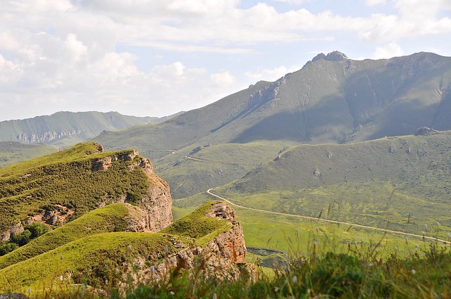 |
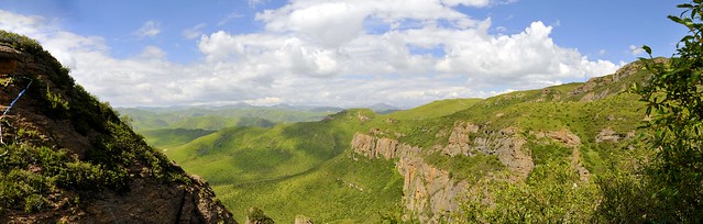
| View of road leading southeast from Langmusi. |
 |
| Finally about to leave, I promise... |
 |
| Mountains to the north, over prayer flags. |
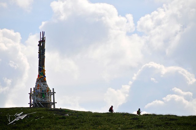 |
| Two of the only other people I saw up there. I am kind of glad the girls turned back, because it was much more tranquil to have the entire space to myself, and I'm sure I enjoyed it more and was less distracted than I might have been. |
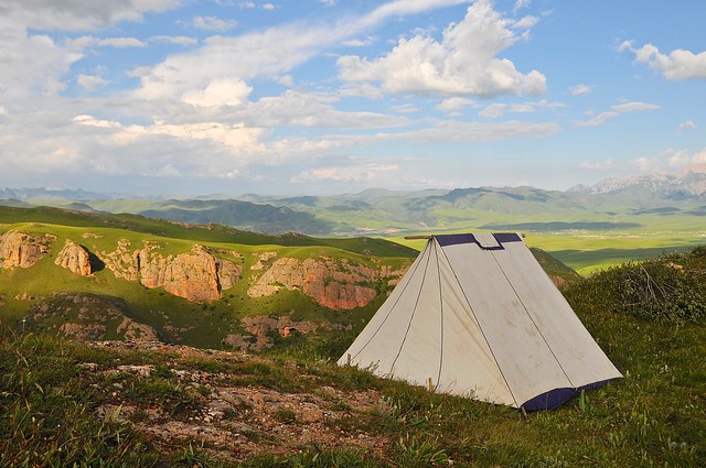
 |
| This would be a marvelous camping spot. |
 |
| Looking back at the tabletop. |
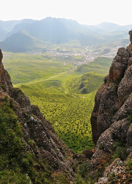 |
| View of the town from the edge of the mountain. |
|
 |
| This Chinese girl was wearing clothes she had bought from a previous trip to Nepal. |
I walked down the mountain and into town with the Chinese girl. She was a schoolteacher from Shanghai, and had traveled outside of China once, to Nepal.I told her I was on my way to Xinjiang, and she made the familiar comment that her parents wouldn't let her travel there, as it was too dangerous. It seemed strange for Chinese to think it dangerous and for parents to tell grown children where they can't travel, but it does make sense for Chinese parents in the one-child era to be extremely protective, and if Chinese are afraid of going to Xinjiang it means the Uyghur tactics are effective (this was 4 years after the 2008 riots in Urumqi).
 |
| We passed the tent on the way down. |
 |
| Descending via a gentle slope towards the back of the mountain. |
 |
| Gorgeous view from the descent. I started on the far left peak, and ascended from the back/north side of the mountain. |
Even though there were pretty easy ways to get up there, I was one of the only people on the mountain. For the first couple of hours I was up there, I only saw four or five other people and, with the exception of the schoolteacher I met at the end, they were all far away. It was pretty magical to be up there on a sunny day—one of the warmest of the year, at about 25°C—in mountaintop fields filled with wild flowers and Tibetan prayer flags, with stunning mountain views. Simply Amazing.
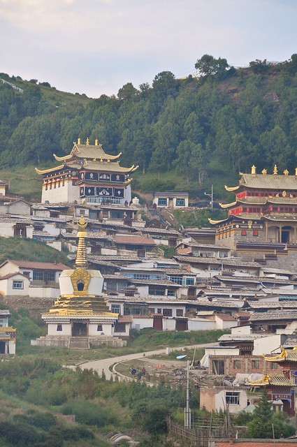 |
| Sertri Gompa, the Gansu-side monastery. |
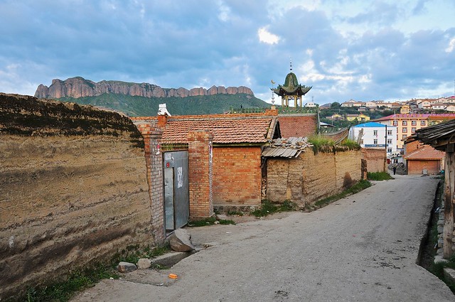 |
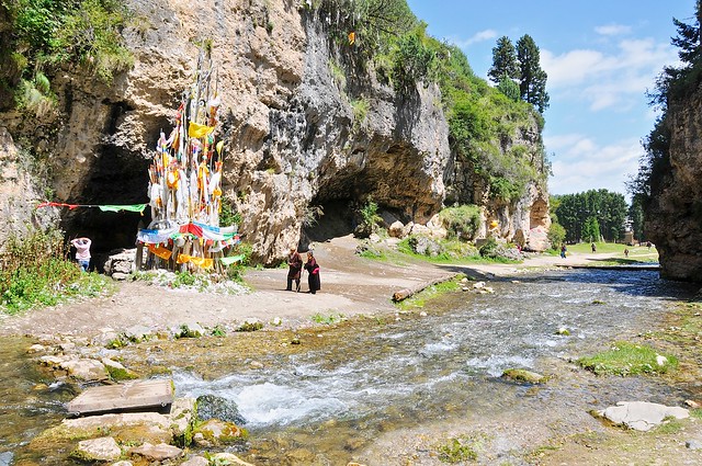
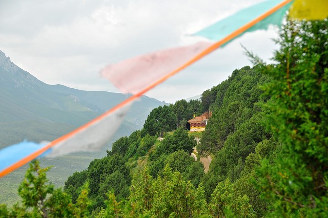
| The Red Rock
Mountain rises behind the town, with the Chinese-style minaret of the
local Hui mosque on its right. The Sichuan-side monastery is just to my
right, and this street runs along its edge. |
Day 2: hiking the mountains behind monastery
On the second day Helit left to head south into Sichuan province, as she wanted to meet up with an Israeli guy she had been talking to online, and planned to travel with him to Hong Kong, where apparently Jewish travelers can stay for free at Chabbad House (I think) so long as they attend classes. I think she missed traveling with others, especially since she traveled along India's
Hummus Trail with other Israelis.
The Spaniard and I decided to hike the Namo Gorge, but not before breakfast. I don't eat breakfast. I don't really eat lunch, either. I usually just grab a snack from a shop (they had really good donut peaches in Langmusi, for some reason) if I'm hungry, or get calories from drinks. Spending time on breakfast and lunch just seems like a big waste of time better spend doing other things, if you ask me. This is why traveling with others can be a pain, especially if they like to take leisurely meals. An hour or so spent lounging over breakfast is just silly.
Even though we had no particular desire to see the Kirti Gompa monastery (sometimes referred to as the Sichuan monastery since it lies on the Sichuan side of town), which blocks direct access from the town to the gorge entrance, the monks there wouldn't let us walk around the monastery, and kept telling us we needed to go buy tickets. Even though you can walk around to monastery and get to the gorge entrance, we relented and bought tickets.
 |
| Entering Namo gorge, with a rare latse marking a spiritual place not at the top of a mountain or ridge. |
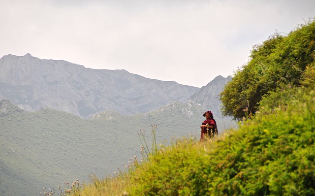
We turned up the first major valley on the left and followed it to the end, climbing the mountain at the end of the valley. There were plenty of yaks and goats along the way, and a Tibetan woman looking over them on the mountain slope at the end of the valley. She got up around dawn to go up there, and had been there ever since, and she asked us for some water to drink.
 |
| Down Namo gorge. There was a big and noisy dog outside these tents, who apparently thought we were a threat from this far away. We turned left at this point. |
 |
| Yaks grazed up and down the valley slopes. |
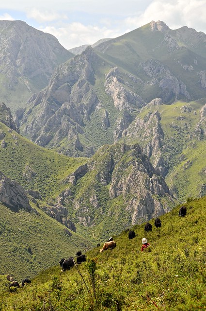 |
| Tibetan yak-herd looking after her animals, from near the top of the mountain, which rises to about 4,000 meters. |
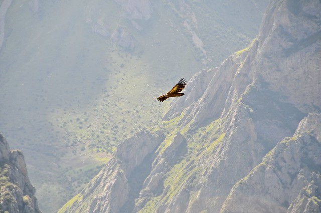 |
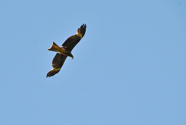
| A Griffon vulture soars in the valley. |
 |
| Looking down the other side of the mountain. Doesn't look too difficult. |
At the top of the mountain you could see down to another ridge, with the Red Rock Mountain in the background. We decided to go down the back of the mountain and over to the other ridge, and although it looked fairly straightforward, things are never as they seem. It involved a fair bit of scrambling and following trails made for short goats and not tall humans, but we made it down the mountain (hard) and up the neighbouring ridge (easy).
 |
| Looking up at our ridge-top destination. |
 |
| Cresting the ridge. |
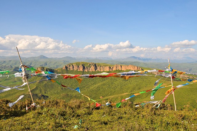 |
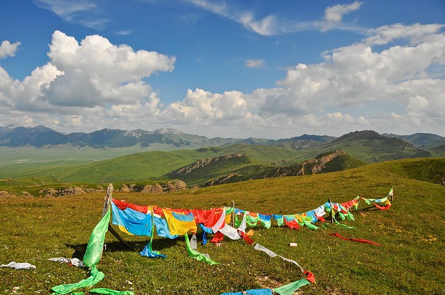
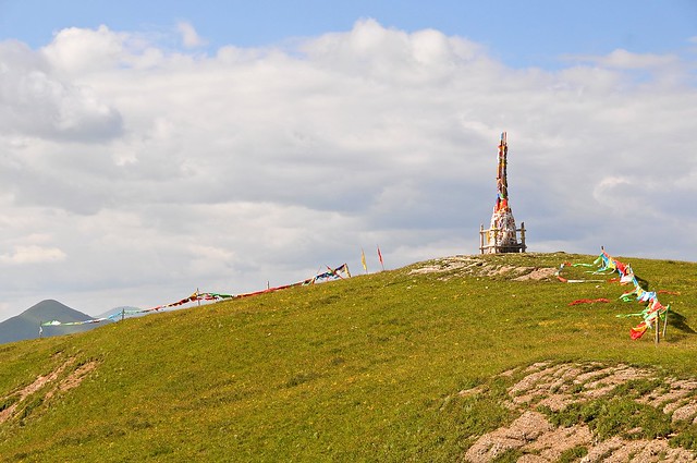
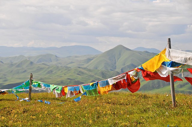
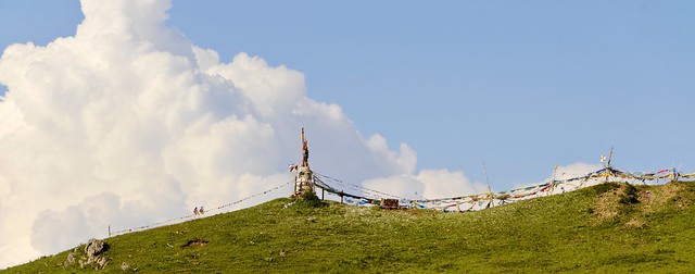
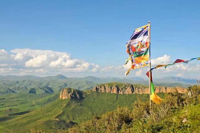
| The Red Rock Mountain over prayer flags. |
 |
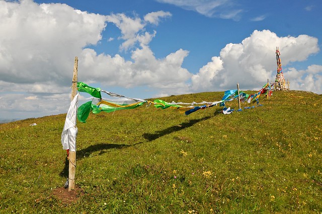
| The flag shows the proper colour progression: blue, white, red, green, yellow. You an see it duplicated in the flags on the line. |
 |
| The latse around Langmusi had poles that resembled arrows, instead of just unpainted and undecorated poles as was more common in Xiahe. |
 |
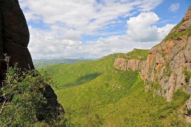
| You can plainly see the easy way to ascend Red Rock Mountain—via the saddle—from here. |
 |
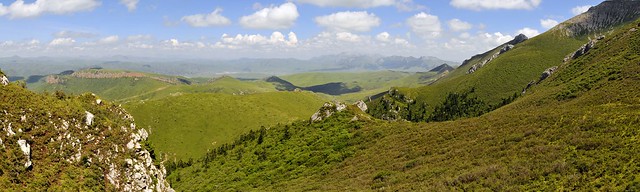
| Looking towards Red Rock. |
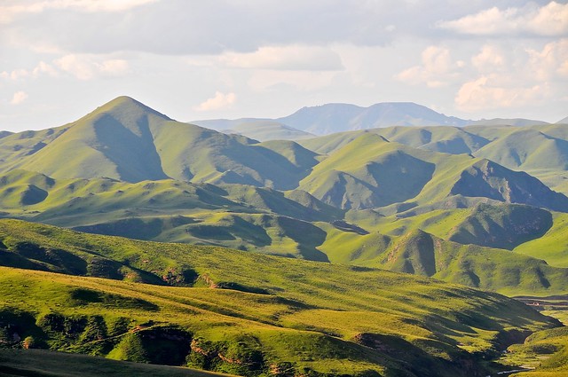 |
| Looking North over the grassy mountains of Gansu. |
Getting back down the ridge, to the road that lay between it and the Red Rock Mountain, was considerably more difficult since the slope was carpeted with thick bushes and the trails that appeared to lead down quickly petered out.
It was scratchy and uncomfortable, but we survived.
Day 3: sky burial site & behind the Gansu monastery
We started the day by visiting the sky burial site northwest of the Gansu monastery. It's an ethically difficult decision whether or not to go, as in some places the Chinese have started to market sky burials as tourist attraction and sell tickets to them, and in any event it's a very public ritual of a very private matter, and something Tibetans are understandably not eager to share with tourists. I know I wouldn't have gone if there was a burial taking place, and I might have turned back if I saw there was a large tour group there. But on the other hand the Chinese schoolteacher also told me that a monk she had met was going to take her there, so there seems to be some openness to having outsiders visit.
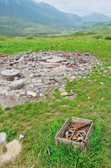 |
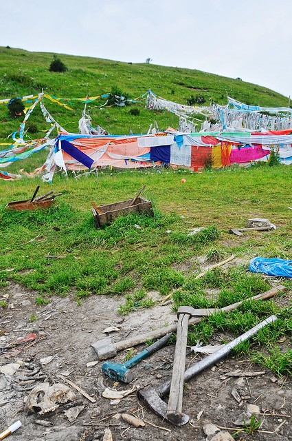
| This is the burial site, looking east down the valley. That's a box of tools for cutting, hacking, chopping, and crushing the body. |
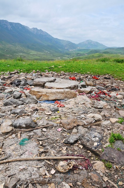 |
| Flat rocks are used as cutting boards. The site is strewn with bones. |
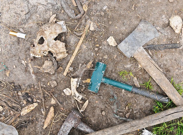 |
| Tools of the trade. |
 |
| There are prayer flags all over the hill just north of the site. |
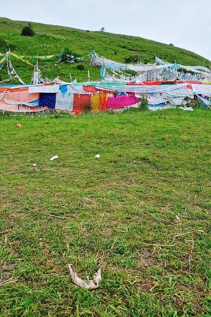 |
| A mandible with a few teeth in it. |
The sky burial site was nothing like what I expected. When I had thought of sky burials in the past, I always imagined them happening on dry, dusty, and rocky mountain. I imagined something very pristine and clean. But that's not at all what I found, as there were boxes of rusty tools, garbage, and clutter. It didn't smell—the vultures do their job well—but it didn't seem like the pure environment I thought it would be. I'm sure the cloudy day and recent rain contributed to this impression, but it was still very different than I had imagined.
As we left the site, we passed a group of seven or eight Chinese coming up the hill to the site. Their lighthearted mood and irreverence seemed totally out of line with the place they were entering, I can't say I was surprised.
We walked along the ridge behind the Gansu monastery. I'm not sure if it was intended to be a kora, but this route was littered with prayer flags, and afforded nice views of he monastery and town below.
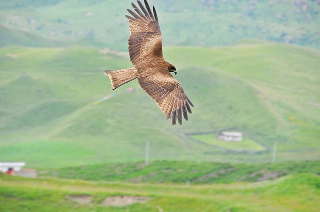 |
| Hawk soars above town. |
 |
| Monastery building through prayer flags. |
 |
| A well-decorated tree, reminiscent of Eej Mod in Sukhbaatar, Mongolia. |
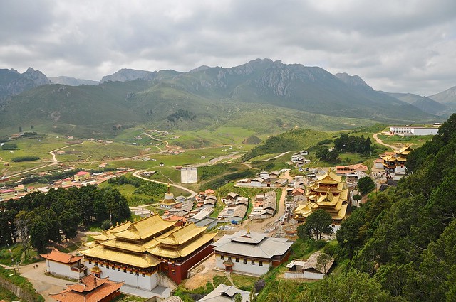 |
| View of the Gansu monastery. |
 |
| A monk enjoys the scenery. |
 |
| Monks having problems with their cart. |
At the end of the
kora, the Spaniard went towards Red Rock, which she hadn't climbed yet, while I headed back to the Sichuan monastery (the entrance ticket was good for multiple days) before heading further east in the valley.
 |
| Goats take shelter in the shade of the Sichuan monastery. |
 |
| Yak and hill near the Sichuan monastery. There was another hug dog chained to a pole near here, and who was none too happy I was in the area. |
 |
| East down the valley. |
 |
| Hawk carrying a stick to its nest. |
 |
| Looking up at the summit. |
 |
| Not so much prayer flags as silk khatag scarves. |
 |
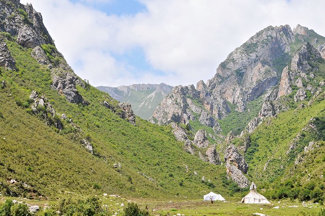
| Another great campsite. |
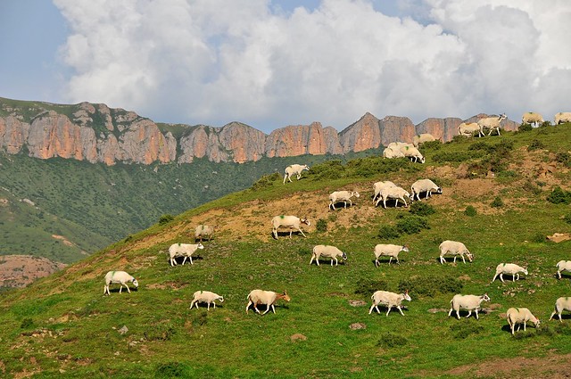 |
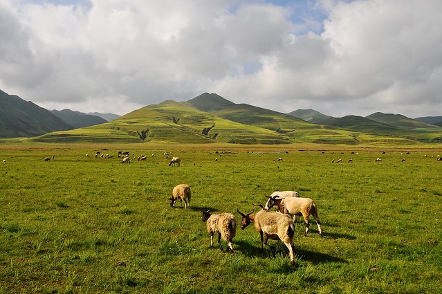
| Sheep pass in front of the Red Rock Mountain. |
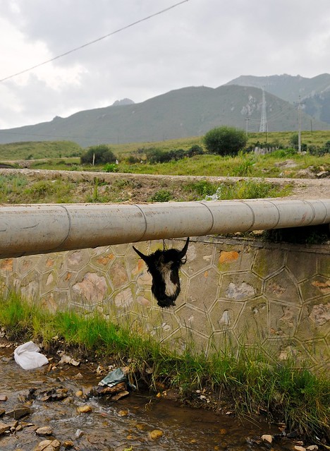 |
| I'm not sure I understand the significance of this Yak head hung beneath this bridge, but it definitely seems more shamanistic and less Buddhist in nature. |
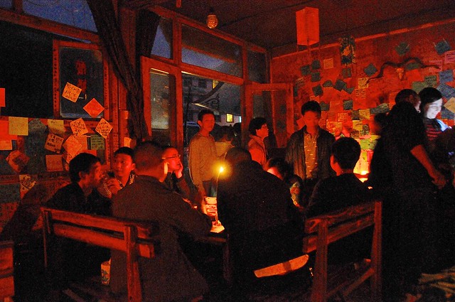 |
| Candle-lit restaurant, after the power goes out. |
The Horse Thief
Martin Scorsese famously ranked the obscure Chinese film
The Horse Thief as his
favourite movie of the 1990s. To some extent this makes sense, given Scorsese's fascination with Tibet (I think
Kundun is highly under-rated, and reflects the spiritual side of Scorsese we really haven't seen much of since mis early masterpiece,
Mean Streets), but in other senses it kind of an incomprehensible choice. Made by a Chinese director, I think it does a decent job of showing some Tibetan customs from an outsider's perspective, and for those who have never seen anything Tibetan it may offer a fascinating—if bewildering—look at what life could possibly be like. But there's little plot and most of the film is nothing more than empty imagery (horribly transferred to DVD), and even though I think that film is a visual medium in a way that TV simply isn't, watching
The Horse Thief after having been to Tibet honestly left me a little bored: the scenery isn't all that different than you might see in Langmusi, and the practices shown were more familiar and less exotic as they might otherwise have been.
Budget
August 9 in Langmusi: 139 yuan
- Bus from Xiahe to Langmusi: 72 yuan
- Hostel: 40 yuan
- Food and drink: 27 yuan
August 10 in Langmusi: 126 yuan
- Hostel: 40 yuan
- Sichuan monastery entrance fee: 30 yuan
- Dinner: 20 yuan
- Breakfast: 20 yuan
- Soda and ice cream: 6 yuan
August 11 in Langmusi: 97 yuan
- Hostel: 40 yuan
- Fruit and drinks: 15 yuan
- Snacks and instant noodles: 12 yuan
- Dinner: 30 yuan

No comments:
Post a Comment